
The focus of applied geophysics is the exploration of the earth's crust using a wide range of geophysical measurement methods. The development and optimization of innovative measuring techniques, their use for deposit exploration, lithosphere research and their application to complex problems in archaeo-physics are the main focuses of our working group.


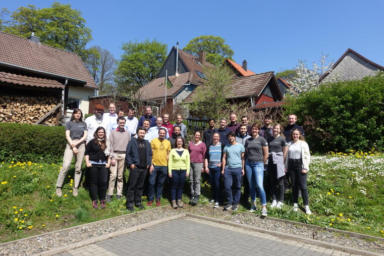
At the end of the DESMEX Real project, a joint final meeting of all project partners was held at Leibniz ipht in Jena. In addition to status reports, summaries and updates, the project goals achieved were also considered in the overall socio-political context, almost 10 years of DESMEX were celebrated and ideas for future cooperation were discussed.
We would like to thank ipht for the great organization of this meeting and all partners of the DESMEX Real project for the successful, enriching and committed cooperation!

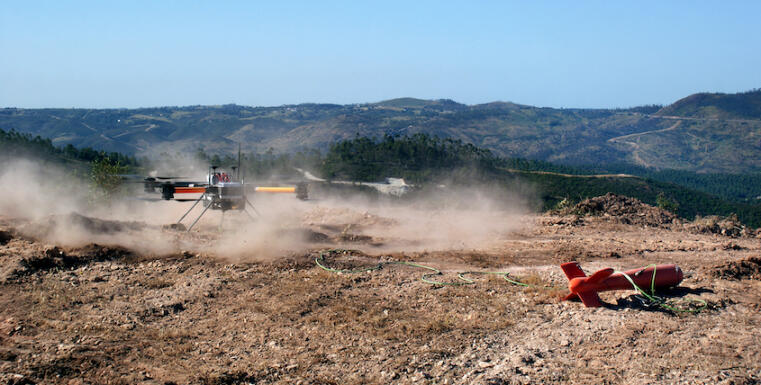
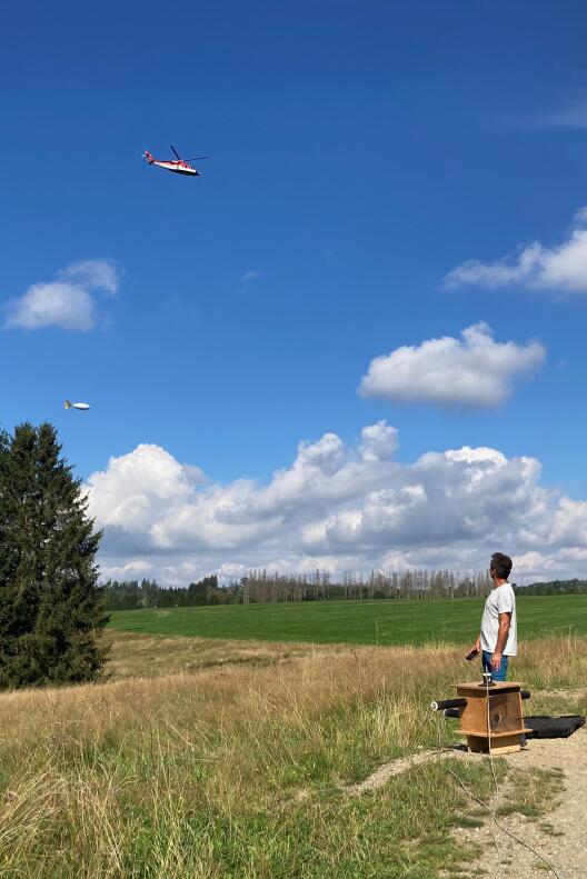
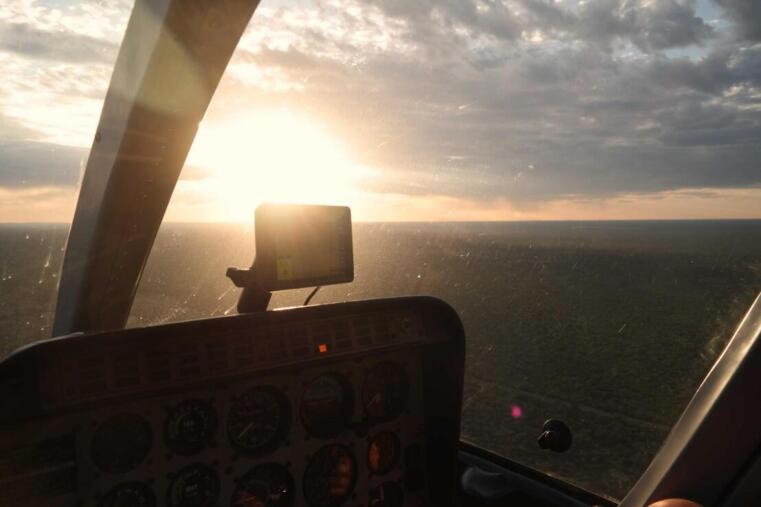
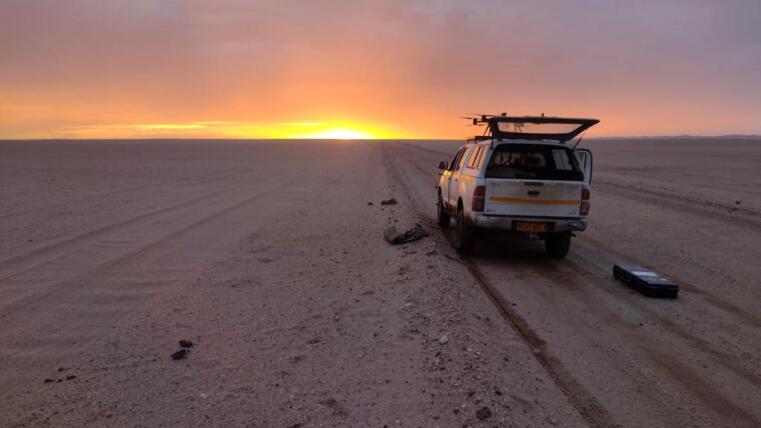
In cooperation with Ongwe Minerals and Terratec Namibia, drone-based semi-airborne electromagnetic measurements were carried out in a prospecting area near Gobabis (Omaheke), Namibia, in March 2025. The survey is part of the Undercover project and aims to explore potential copper deposits under Kalahari sand cover. The Kalahari Copper Belt extends for several 100km along a Mesoproterozoic rift system in a NE-SW direction in Namibia and Botswana. The Botswana side has relevant copper and silver deposits, which are also expected in the Namibian part due to the same geological history. As the 10-100m thick sand layer makes direct sampling difficult, the aim is to check whether semi-airborne electromagnetics can help to identify mineralization zones with an increased copper content.


At the start of the Unified Novel Deep ExploRation for Critical Ore discoVERy (UNDERCOVER) project, the project partners met for a kick-off meeting in Ruka, near Kuusamo, Finland. Hosted and organized by GTK, the project started with many productive discussions and with sparkling northern lights.
More information about the project can be found on Linkedin and the project website.
Obinna Benedict Nwosu has successfully submitted and defended his doctoral thesis on topic 3D Inversion of global geomagnetic data using an elastic net approach. We warmly congratulate and wish him all the best for the time ahead!
Two new sensor platforms (‘MagBird’) have been built for the ‘MagArrow’ magnetometer, which is used for drone-based measurements. These can be suspended lower to reduce the influence of drone noise.

The last meeting of the DESMEX-Real project took place on 26 and 27 November at the Hotel zum Harzer. In addition to status reports on the processing of the collected data and geological, geochemical and technical research questions, the focus was on the discussion of perspectives and further plans.
The 4th GeoMeTer workshop took place from 12-13 November at the Institute of Geophysics at the University of Münster. During the workshop, the status of the project work was presented and discussed and next steps in both research regions were discussed. Around 30 people took part in the workshop.
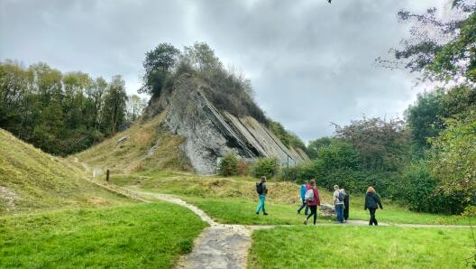
The annual field course for Bachelor students took place from 27 September to 6 October. Objectives are to get to know and practise various geophysical measurements under realistic conditions and to work in an international team, as the course takes place jointly with the Universities of Paris-Saclay and Edinburgh. This year, 8 students and 2 teachers from Münster travelled to England to carry out measurements in Telford, near Birmingham.
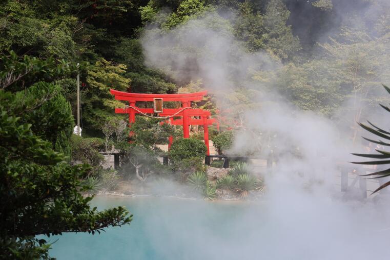
The 26th EM Induction Workshop, a one-week conference on electromagnetic geophysical methods, took place from 7-13 September in Beppu, Japan. For the 5 participants of the Applied Geophysics Münster working group, the programme included a lot of professional exchange as well as excursions to the craters of the Aso volcano and exploring the city of Beppu, which is known for its very high geothermal activity.
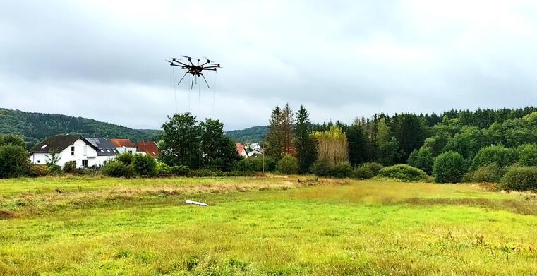
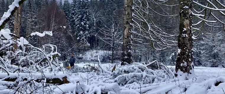
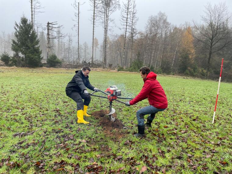
In September, we carried out drone-based magnetic measurements near Sötern in the Saarland, which is believed to be the site of a former castle. Because the terrain is very swampy and covered with tall grasses and bushes, conventional measurements on the ground would not be practicable. Drone-based measurements are a possibility to collect geophysical data even in such areas.
Johanna Plett successfully defended her master thesis with the title Spectral estimators for stochastic and deterministic signals with application in magnetotellurics and semi-airborne em case studies.
Congratulations to her!
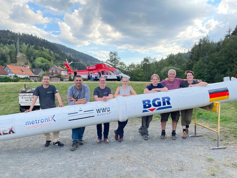
From 13. - 23.8.24 semi-airborne electromagnetic measurements were carried out as part of the DESMEX-Real project. A total of 10 flights south of Clausthal-Zellerfeld were successfully completed.
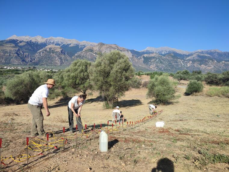
Together with archaeologists from the Classical Archaeology Department in Münster, geophysical measurements were carried out at the beginning of August to search for settlements in the vicinity of the Apollo-Amyklaios sanctuary. A newly built geomagnetic trolley was used for the Geometrics G-864.

A meeting of all partners of the DESMEX-REAL project took place on April 18 and 19 in Clausthal-Zellerfeld. The meeting focused on the consolidation of results achieved so far and the planning of the Harz survey in August 2024. Contributions included reports on current measurement campaigns, progress in the development of electromagnetic field sensors, sensor platforms and towed sensors, preliminary geophysical subsurface models of the Harz and the integration with existing geological models. The historic market square of the town of Clausthal-Zellerfeld was also visited, where a public event will be held on August 13 to inform the public about the aims and background of the joint project.
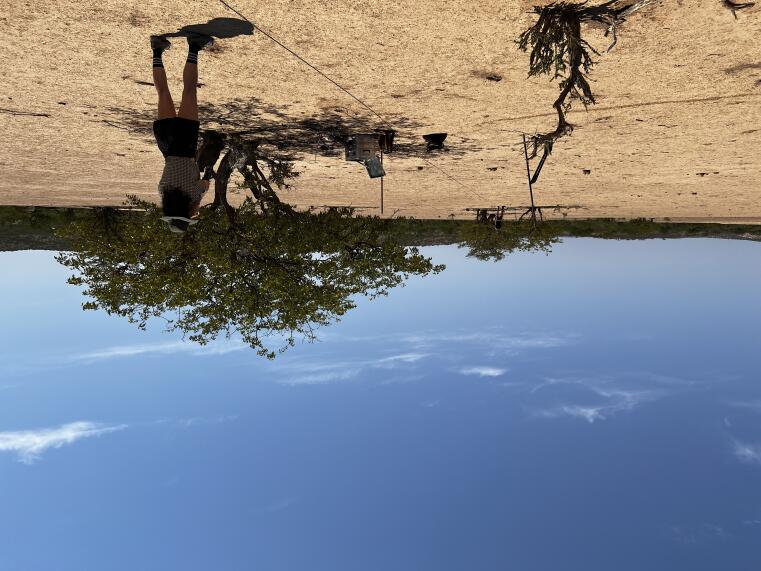
Magnetotelluric measurements were carried out near Khorixas, Namibia, as part of a two-week Master's field course. The aim of the measurements was to investigate conductive structures in the crust and their correlation with mineralisation at the surface. A total of 18 broadband MT stations were installed and additional short-term measurements were carried out at a further 26 points. The field course was supported by Ongwe Minerals (Namibia) in terms of content and logistics.
Parallel to the field course, drone-based semi-airborne EM test measurements were carried out to investigate the sources of a geomagnetic anomaly in more detail. The drone measurements were carried out as part of the DESMEX-REAL project.
We congratulate Hannah Treppke and Sebastian Schwind on the completion of the Master of Science Geophysics and at the same time are pleased to welcome Hannah as a PhD student starting October 01.
Prof. Matthew Comeau has accepted a position as Assistant Professor at TU Delft. We congratulate Matthew, wish him good luck for the future and thank him for the successful and enjoyable collaboration during the last years!
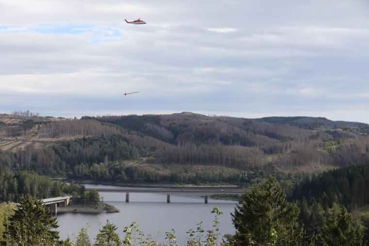
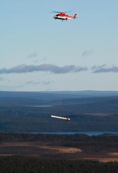
Once again, semi-airborne EM data were collected in the Upper Harz Mountains around Schulenberg. The measurement campaign is part of the DESMEX-Real project, in the context of which the entire mining region of the Upper Harz is surveyed. In previous years, flights were carried out in the area of Lautenthal, Bad Grund and Goslar.
Click here for media reportage by NDR and Sat1 (as of October 2023).
In cooperation with the French company ERAMET and the German company DEM, two pilot studies were carried out in Argentina. The aim of the measurements was the detection of highly conductive lithium brine in the subsurface. Both test areas were located in the Argentine Andes at an altitude of 3500 m. One test site was a dry salt lake (salar) and the other was located in a volcanic area. The processing of the data obtained will show the suitability of the DESMEX method for this type of deposits.
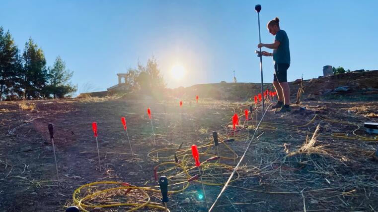
As a continuation of the archaeo-geophysical measurements last summer, further measurements were carried out near Sparta, Greece. The aim is to discover archaeological structures at the sanctuary of Apollo Amyklaios in cooperation with the Institute for Classical and Christian Archaeology at WWU Münster and the Ionian University of Corfu.
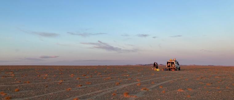
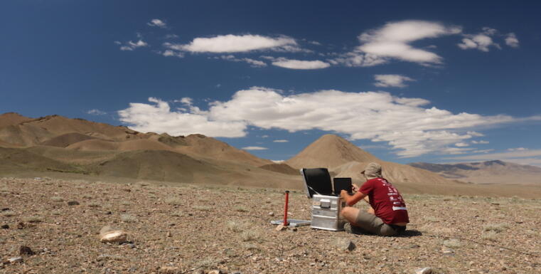
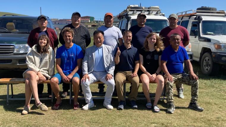
This year's magnetotelluric measurements took place in western Mongolia in collaboration with partners from the Institute of Astronomy and Geophysics (IAG) in Ulaanbaatar. These measurements add 150 stations to the existing data set and contribute to the development of possible geodynamic scenarios for the origin and understanding of the lithospheric deformation at hand.
On May 11 and 12, a project meeting of the project partners involved in DESMEX II and DESMEX-REAL took place in the Hotel zum Harzer not far from the airborne survey areas in the Harz Mountains. On the agenda were various reports on the status of the work, an introduction to the geology of the Harz, as well as the planning and selection of future measurement and model areas. Accompanied by a renowned mineralogist, a geological hike was organized.
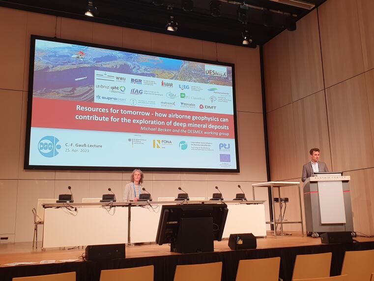
This year's Gauss Lecture at the EGU conference in Vienna was held by Prof. Michael Becken. With the title "Resources for tomorrow - how airborne geophysics can contribute for the exploration of deep mineral deposits" he presented the functionality and representative case studies of the semi-airborne EM techniques developed in the DESMEX projects.
Used slides for download as well as a video recording (in English) can be found on the DGG website.
André Bredeck successfully defended his master thesis with the title "Development of methods for UXO detection with omnidirectional borehole GPR" and now holds his master's degree.
We congratulate and wish all the best for the future!
The Bundesgesellschaft für Endlagerung (BGE) announced the start of the research project “GeoMetEr” through a kick-off meeting on 5. April 2023. The project coordinator, TU Bergakademie Freiberg, hosted the meeting on their premises. All ten project partners, including WWU Münster, participated in the meeting to discuss the future aspects of the scientific and logistic workflows throughout the project.
The discussion addressed the working phases during the project, starting with a detailed illustration of the proposed exploration techniques such as 3D seismics, airborne geomagnetics, and semi-airborne electromagnetics. The project members also reviewed the validation techniques that will be used to provide more confidence in the exploration results, in addition to introducing the innovative joint inversion and modeling schemes that will be implemented for a compressive understanding of the subsurface.
During the meeting, the WWU Münster team presented results of the previously conducted test measurements in the Sigmaringen area. The results provided insights into the distribution and intensity of the electromagnetic disturbances in the area that will be taken into account while conducting the electromagnetic survey.
GeoMetEr is a research project of the Bundesgesellschaft für Endlagerung (BGE) in cooperation with a project group led by the University of Freiberg, in which the Applied Geophysics Group of the University of Münster is also involved. The objective is to test various minimally invasive, surface geophysical measurement methods, such as airborne EM, for the subsequent selection of a repository site. Further information on the project and the search for a final repository can be found on the website of the BGE.
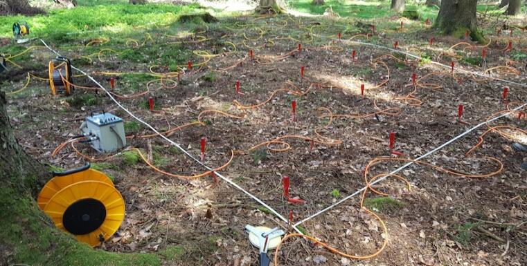
In March 2023, the University of Münster carried out the first test measurements in the Sigmaringen district to assess the influence of potential EM noise sources, such as transmission towers. This information will be used to define a research area for testing further exploration methods.
In February, the first helicopter-based AFMAG measurements were carried out as part of the DESMEX II project. AFMAG stands for audio frequency magnetics and, like magnetotellurics, is based on natural electromagnetic sources. Participating partners are the Federal Institute for Geosciences and Natural Resources (BGR) and the Leibniz Institute for Photonic Technologies (IPHT).
To demonstrate the method, a region near Gobabis in Namibia was selected for which a coarsely resolved AFMAG comparison data set already exists.
In the first weeks of January, complementary investigations of the Hope copper mine in Namibia were carried out in collaboration with terratec Geophysical Services, following on from the successful sAEM measurements in 2021.
The semi-airborne electromagnetic methods developed within the DESMEX projects are particularly well suited for deep exploration of deposits, such as the exploration of this shallow-dipping massive sulphide deposit
On 12 January 2023, Swedish mining company LKAB announced the discovery of a large deposit of rare earth metals in Kiruna - a site that was used to test DESMEX methods in 2018.
At that time, the iron ore deposit located there was investigated, which is considered one of the largest in the world and a suitable target for validating the DESMEX exploration methods. The resulting geological subsurface models also contributed to the exploration of the rare earth metal deposits.
Click here for the article in the news portal of the University of Münster:
https://www.uni-muenster.de/news/view.php?cmdid=13080&lang=en
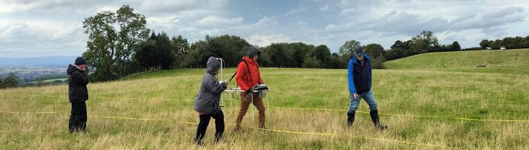
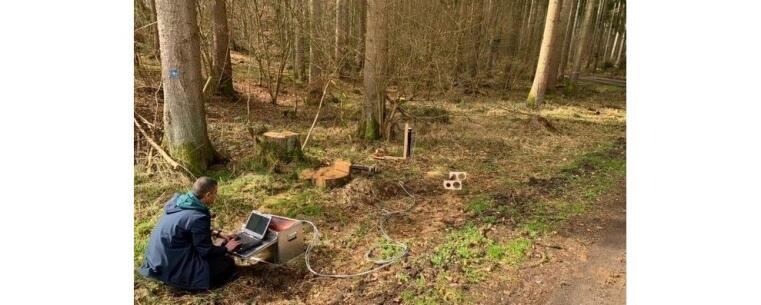
The working group installed stations for telluric broadband measurements and magnetic field measurements with fluxgate magnetometers in the Sauerland. The aim is to check the feasibility of long-term magnetotelluric measurements to obtain long-period H- and E-field data with regard to temperature-related sensor instability.
New helicopter-borne semi-airborne EM data will be acquired in the upper Harz mountains. The measurements are part of the DESMEX-REAL project and will be centered around Lautenthal.
Comeau, M. J., Becken, M., and Kuvshinov, A. V. (2022). Imaging the whole-lithosphere architecture of a mineral system—Geophysical signatures of the sources and pathways of ore-forming fluids. Geochemistry, Geophysics, Geosystems, 23, e2022GC010379. https://doi.org/10.1029/2022GC010379
Becken, M., Kotowski, P.O., Schmalzl, J., Symons, G., Brauch, K., 2022. Semi-Airborne Electromagnetic Exploration Using a Scalar Magnetometer Suspended below a Multicopter. First Break, 40(8), 37-46. https://doi.org/10.3997/1365-2397.fb2022064
Stolz, R., Schiffler, M., Becken, M., Thiede, A., Schneider, M., Chubak, G., Marsden, P., Bergshjorth, A.B., and Schaefer, M., and Terblanche, O. (2022). SQUIDs for magnetic and electromagnetic methods in mineral exploration. Miner Econ. https://doi.org/10.1007/s13563-022-00333-3
The working group has carried out new magnetotelluric measurements in the Hovsgol region in northern Mongolia together with partners from the Institute of Astronomy and Geophysics (IAG), Ulaanbaatar. New data at 86 sites were acquired and complement the existing array. The new and existing data will be used to test geodynamic hypotheses for lithospheric deformation at the edge of the Siberian platform.
Archeo-geophysical measurements were carried out near Sparta, Greece, to unravel hidden archeological structures at the Apollon Amyklaios sanctuary near Sparta. Measurements were conducted in cooperation with the Institute for Classical and Christian Archaeology of the WWU Münster and the Ionian University of Corfu.
More Informations on the Project